

London Map and Gazetteer app for iPhone and iPad
Developer: Caversham Telecom Ltd
First release : 17 Mar 2015
App size: 0 Bytes
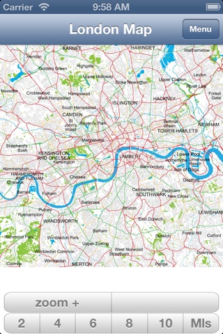
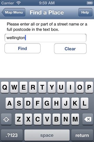
A self-contained London Street Map including an easy to search gazetteer listing 20,000 streets and 93,000 postcodes. It uses Ordnance Survey maps and data.
It extends from Barnes in the west to Bow in the east and from Hornsey in the north to Dulwich in the south and covers over 150 square miles.
Now shows London Underground, Docklands Light Railway and Railtrack stations and works on the tube.
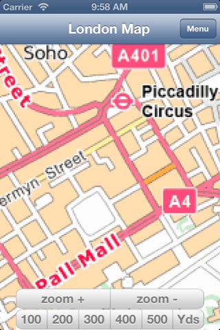
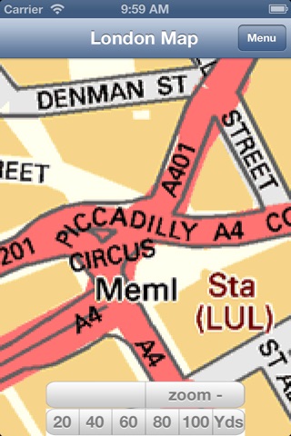
Easy, touch-screen, map selection. Panning across maps is supported by simple finger drag. The top zoom level is a London map and there are four zoom levels down to detailed street level – all in colour. Please refer to the screen shots to see the excellent detail provided.
Once installed this application is completely stand-alone and does not use or require any Internet connection. As a result, it works anywhere including on the underground.
Contains Ordnance Survey data © Crown copyright and database right 2015.
Contains Royal Mail data © Royal Mail copyright and database right 2015.
Contains National Statistics data © Crown copyright and database right 2015.
This app is not endorsed by Ordnance Survey nor any other UK government agency.
A particularly clear and easy to use map of London.